blah blah blah
Waterville Cascades
Length: 3.4 miles out-and-back with loopDifficulty (click for info): Easy
Elevation Gain: 550 feet (-150 feet)
Rating (click for info): 7/10
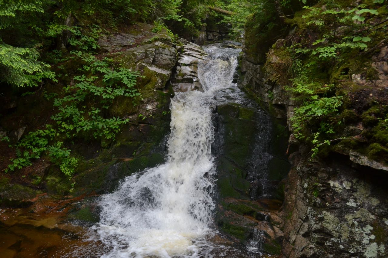
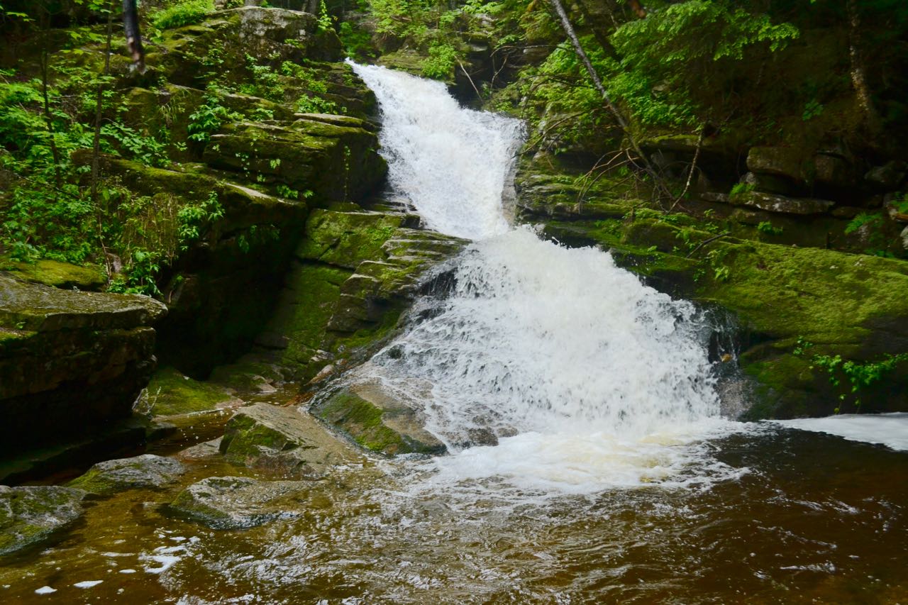
Height: 20' (tallest fall); 160' (total drop)
Driving Directions:
Trailhead and parking area are on Boulder Path Road in Waterville Valley, NH. Drive 11.2 miles northeast on Rt. 49 from exit 28 off I-93, and Boulder Path Road will be on the right as you round a corner to the left by the golf course. This is 1.0 mile after passing Tripoli Road and the entrance to the ski area. Drive 0.5 miles on Boulder Path Road and look for a large dirt parking area on the right just before Cascade Ridge Road. This is the parking for Snows Mountain Ski Area. Click here for a Google map.
About the Hike:
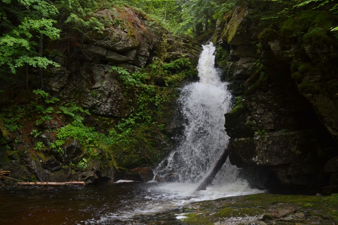
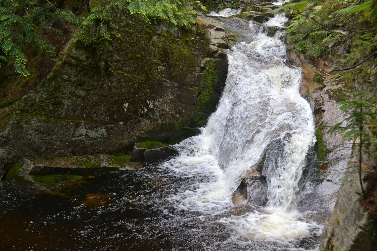
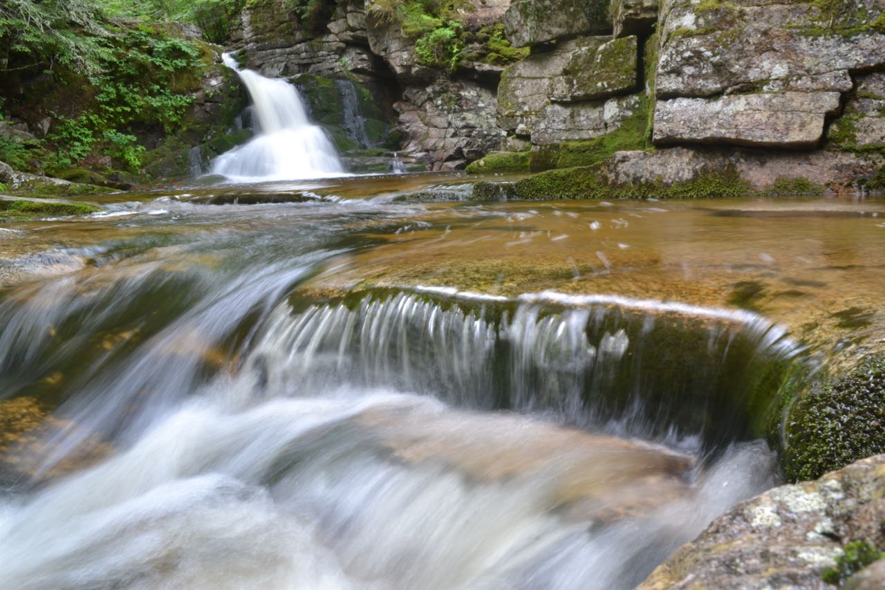
These picturesque cascades in the quaint town of Waterville Valley make for one of the most enjoyable and rewarding waterfall hikes in New Hampshire. After an easy walk in the woods, a loop encircles the cascades, passing numerous drops, fans, rapids, and pools in Cascade Brook. Each feature on this gorgeous brook will compel you stay a while, take pictures, and explore further.
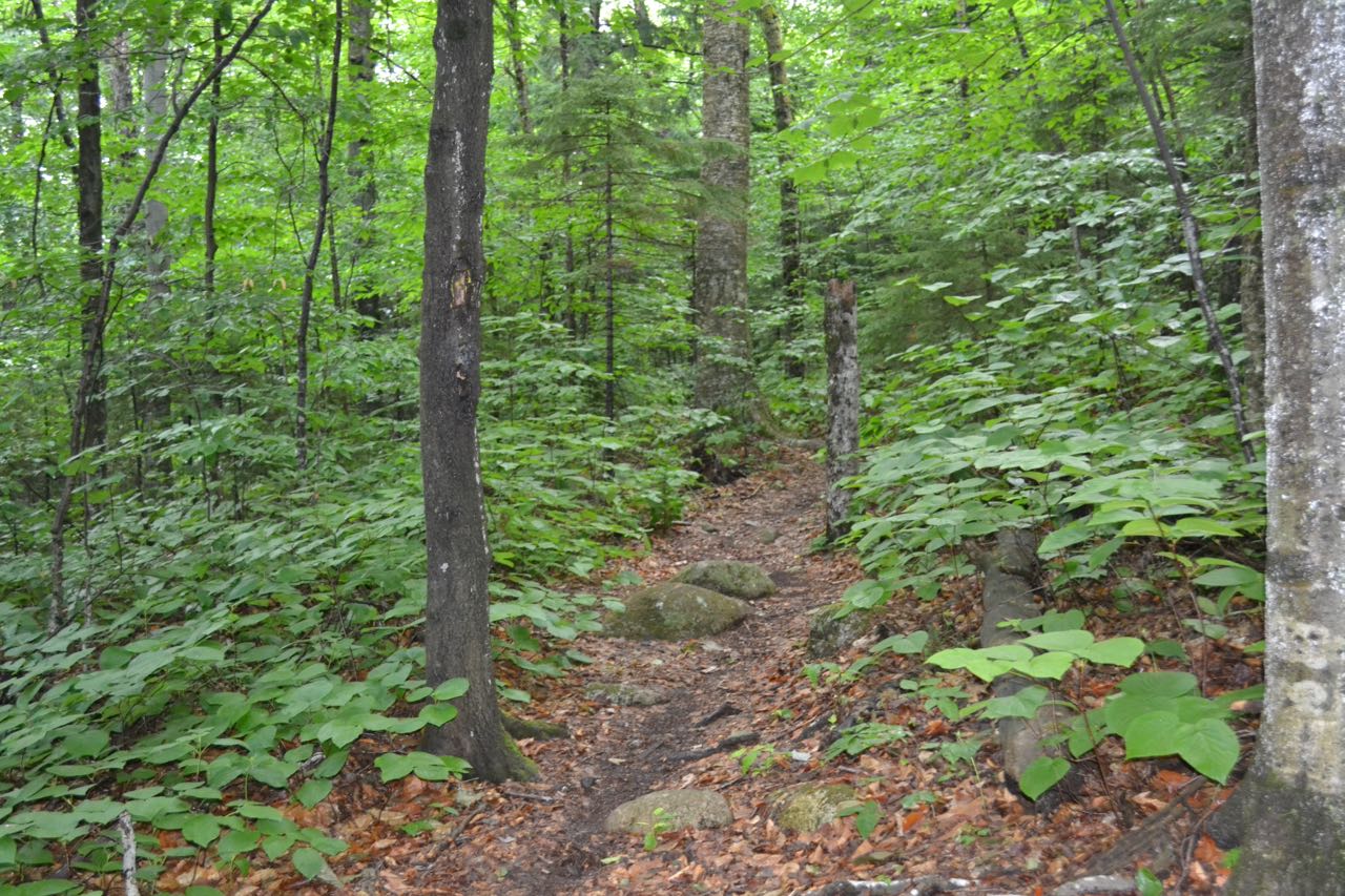
The hike begins at the Snows Mountain Ski Area parking. Cross Cascade Ridge Road and head across the grass past the sign for Cascade Path, climbing alongside the road past several houses. Soon, the trail enters the woods, then passes Boulder Path on the left, 0.2 miles from the parking area. Just past this, the trail climbs back to the road and crosses it again. Continue up a ski trail for a short distance, then turn left into the woods at a trail sign. Quickly cross another ski trail and pass Elephant Rock Trail on the right in 0.2 miles. The trail continues easily through the forest, then descends gradually for 0.6 miles before the trail joins another ski trail, just after crossing a bridge over a small brook. Turn right and follow the ski trail to a bridge over Cascade Brook, where Norway Rapids Trail turns left and crosses the bridge. Bear right, leaving the ski trail to stay on Cascade Path. You will soon arrive at the loop junction. Cascade Path turns left and crosses the brook while Westside Loop climbs the bank on the right side. At this junction, you will find the first cascade, a beautiful fanning waterfall.
For what we feel is the most scenic way, bear right onto Westside Loop. As you hike this trail, watch for openings on the left side to be sure you find all the best viewpoints. You will soon pass a viewpoint providing a different perspective of the cascade you just saw. Continue upward along the bank. Next, step out to a ledgy spot in the brook for more brook scenery. Here, next to a water slide and above a circular pool, you can venture up to a small, rocky plunge. Further up the trail, you will find a path out to a precipitous viewpoint over a short and wide fall and another large pool. Scenery continues as the trail passes another place to climb down to the brook and see an impressive plunge, then goes by a viewpoint high above it. After 0.3 miles of wonderful brook scenery, the trail reaches the far end of the loop at an old dirt road. Turn left, cross a wide bridge over the brook, then turn left back onto Cascade Path. This side of the loop provides different viewpoints of all the cascades you saw on the other side, and most of them are easier to reach. If you missed anything on the Westside Loop, you will most likely get to see it here. Look for one long waterslide just past the bridge which couldn't be seen from the other side. In 0.3 miles from the dirt road, cross the brook and arrive back at the loop junction. For a detour with limited views, turn left onto Elephant Rock Trail on the way back and follow it to Snows Mountain Ski Area.
Printable directions page